Kayaking the waters of Louisiana is a joy. Surrounded by nature, even the nearby Big Easy seems far away. You can choose your paddling style–right in town, out on the Gulf, or winding through the bayous and sloughs.
For more kayaking destinations nearby, check out our post on the best places to kayak in Louisiana.
1. Bayou St. John, LA
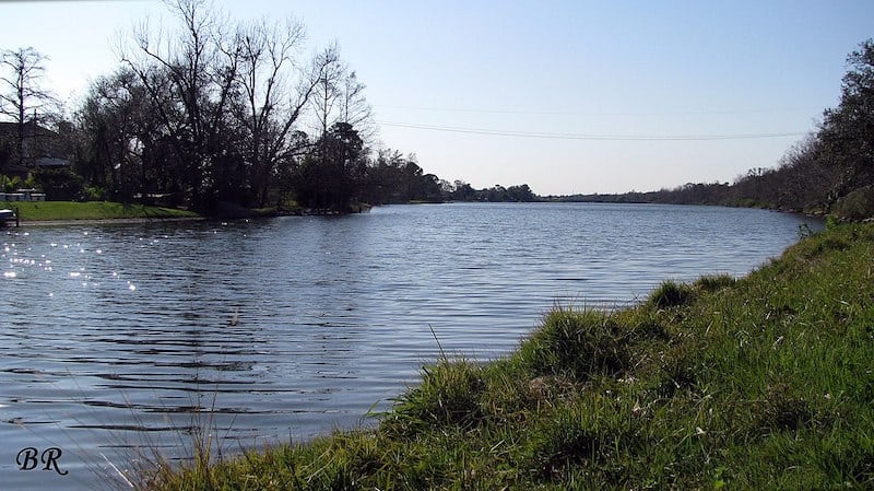
Bayou St. John is a peaceful way to get out on the water, enjoy some sunshine and fresh air–all without leaving the city’s parish. It’s urban–but it’s also quiet and lovely, like all watersports activities can be. The bayou’s waters are calm, with little open space for wind to build up a chop. It’s the perfect place to bring kids or to kayak for the first time.
The route along the bayou winds through historic NOLA neighborhoods and under a few bridges. Most of the west side is dominated by New Orleans City Park. If water levels are very high, getting under the bridges might be a challenge! The short bridges keep regular boats out, so you’ll enjoy the peaceful surroundings with only a few other paddlers.
The area between the Orleans Avenue Bridge and the Robert E. Lee Bridge offers the best paddling.
From Interstate I-10, take the City Park Avenue/Metairie Road exit and head towards the park. Take a right on Moss Street which parallels the bayou. The launch is at the Dumaine Street Bridge.
For rentals, check out either Bayou Paddlesports or Kayak-Iti-Yat Kayak Tours, both of which are along Moss Street, which also parallels the east side of the bayou. Bayou Paddlesports is just south of Interstate I-610 on Florida Avenue, while Kayak-Iti-Yat is just south of the Lelong Drive bridge.
2. Bayou Bienvenue, LA
Bayou Bienvenue lies just east of the city, at the intersection of the Gulf Intracoastal Waterway and Lake Borgne’s shores. Even though the spot is close to town, it’s a fantastic getaway and the perfect spot for nature and wildlife lovers. You’ll see eagles, hawks, ospreys, and pelicans fishing in the bayou.
While there are some open areas in Bayou Bienvenue, much of it is protected by marsh grasses and the remnants of the original cypress forests.
There are a few ways to access the bayou. The most straightforward is likely from the marinas and ramps along Paris Road. Start at the Bayou Bienvenue Marina at 2001 Paris Road, New Orleans, LA, 70129. You can launch from the east or the west side of the road.
Another popular launch spot is off of Florida Avenue in the Lower Ninth Ward. The Lower Nine Fruit Park has parking along the levee. However, the problem here is that you’ll need to carry your kayak up and over the levee, a set of railroad tracks, and finally into the bayou at the Bayou Bienvenue Wetland Platform. From here, you’ll paddle north and east towards Paris Road to explore the bayou.
For rentals, head over to NOLA Kayak Tours who will sort you out.
3. Bayou Segnette State Park, LA

On the south side of town, where the freshwater bayous meet the salt marshes, you’ll find Bayou Segnette. This spot is popular with anglers of all sorts, along with campers, hikers, and wildlife spotters. If you’re looking for a spot to stay during a trip to NOLA, the state park offers a campground and nice cabins right on the water!
Kayak fishermen will love the big catches of bass, redfish, and catfish that the area is known for. But if you’re looking for a quiet day on the water, the bayou provides ample spots to get away from the city and spot some amazing birdlife.
Bayou Segnette is about 30 miles south of New Orleans on the south side of the Mississippi River. From Highway 90 in Avondale, take Lapalco Boulevard to the main park entrance.
4. Fort Proctor, LA
On the shores of Lake Borgne, about an hour out of town, you’ll find Fort Proctor. But you’ll only find it if you’ve got a kayak and a sense of adventure because this one is off the beaten path.
The adventure takes you by car to the small village of Shell Beach in St. Bernard Parish. From the launch, you cross the Mississippi River Gulf Outlet (MRGO) canal and follow the winding Bayou Yscloskey into Lake Borgne. There’s not all that much traffic out here, so even though it looks busy and intimidating, your passage will likely be smooth. However, it is an open route with no protection from the wind or seas in the Gulf, so make sure to head out on good weather days.
The journey from town to the fort only takes you about 30 minutes. You can see your destination the entire way, so it would be challenging to get disoriented.
The fort was designed to help defend New Orleans’ water routes, but it was heavily damaged during a hurricane during construction. Then the Civil War broke out, and improvements in artillery made the fort’s design obsolete. It was never manned or used, but it was added to the National Register of Historic Places in 1978.
To get to Fort Proctor, you’ll put in at the town of Shell Beach. At the end of Louisiana Highway 46/Yscloskey Highway, there is a lot and a rocky put-in available for use.
5. Manchac Wildlife Management Area, LA
North of town, you’ll find the Bayou Manchac and the Manchac Swamp. Unlike the areas closer to town, this area is a swamp in the classic sense. There are winding paddle ways through towering cypress forests. As you pick your way through the gorgeous bayous and sloughs in the area, you’ll see alligators, fish, and birds of every description.
The Manchac wetlands are bordered on the east by Lake Pontchartrain. They surround Lake Maurepas and extend up to Baton Rouge. The highest spine of land in the area now carries Interstate I-55 north out of NOLA. In all, there are about 200 square miles of forested wetlands in the area.
This is a vast area, with lots of canals, rivers, and sloughs to wind your way up and down. Study the satellite before you head out and develop a fun route that considers the wind and weather conditions.
Manchac Swamp is a little more than a half-hour from New Orleans. It is best accessed along Old Highway 51, which runs parallel to Interstate I-55 in the town of Akers. For rentals check out Guided Manchac Tours (be sure to check out their starlit nighttime tours) and NOLA Kayak Tours – Manchac Swamp Kayak Tour.
6. Bayou Sauvage National Wildlife Refuge, LA

On the northeast side of town bordering Lake Pontchartrain is Bayou Sauvage. The quiet waters of this bayou are a wildlife lover’s and birder’s dream. Wading birds line the shallow marshes, and you’ll likely see noble egrets, stoic herons, and even colorful roseate spoonbills.
The wildlife refuge protects more than 23,000 acres of marsh, all of which are within NOLA’s city limits. It’s the nation’s largest urban wildlife refuge–but calling it urban is disingenuous. It’s out of town, quiet, and feels remote even though you didn’t have to drive all day to get here. It’s only about 15 minutes from the French Quarter!
The best time of year to visit is between May and July or over winter when thousands of birds come here to breed and feed on fish, crabs, and shrimp that are plentiful in these lagoons. Over 340 species of birds have been recorded to pass through here at various points during the year. You can fish, bird watch, hike, or paddle in the refuge, but no hunting is allowed.
Take Interstate I-10 eastbound to Interstate I-510 at exit 246A. Then, take I-510 two miles to Highway 90 eastbound, and continue for four more miles.
7. Jean Lafitte Historical National Park & Barataria Preserve, LA

Located south of NOLA, the Jean Lafitte National Park. The spot is home to a serene estuary and is home to wide-open spaces filled with egrets, blackbirds, herons, and eagles.
The trails at the Barataria Preserve are beautiful, but unfortunately, they have been closed due to a few years of heavy aquatic vegetation growth. When the trails reopen, notices will be posted on this website. There are plenty of other sites to explore in the area, however.
Since the main park trails are closed, head over to Swamp Explorers in Crown Point to check out the area. Take Louisiana SR 301 all the way west–you’ll find them almost at the end of the road. To rent a kayak head over to Swamp Explorers.
8. Bogue Chitto River, LA
The Bogue Chitto River parallels the Louisiana/Mississippi state line as it winds its way to the Gulf. The river is surrounded by one of the largest protected wetland ecosystems in the country–needless to say, there is plenty to see.
The river is a popular tubing destination. It is, in essence, nature’s most perfect “lazy river.” But the outfitter rents kayaks too, and their shuttle service makes it the perfect easy do for a peaceful paddle.
The river is lined with sandy beaches. You can’t imagine a prettier place for a leisurely paddle – it’s a must-see destination.
Bogue Chitto is located north of town. Take the Lake Pontchartrain Causeway to Covington, then follow Louisiana State Route 21 to SR 1082 northbound. It’s about an hour north of New Orleans. The address is 10237 S. Choctaw Road, Bogalusa, LA, 70427. For those who don’t have their own kayak check out Bogue Chitto Tubing and Kayaks to rent one.
9. Fontainebleau State Park, Cane Bayou, LA

Head to the north shore of Lake Pontchartrain to the town of Mandeville, and you’ll find Fontainebleau State Park. The park is based on the ruins of an 1829 sugar mill that ran until 1852.
The park features stunning views of Lake Pontchartrain from a long sandy beach. There are trails and a campground, plus some really neat lakefront cabins. While you can paddle in the open lake, the best scenery is found along Cane Bayou. This winding creek runs its way from the launch off of US 190 to the lake. It’s twisting and wild–you’re sure to see lots of wildlife as you navigate the pristine waters.
The most direct put-in for Cane Bayou lies right off of US Highway 190/Ronald Reagan Highway. If you don’t have your own yak, check out Bayou Adventure.
10. The Pearl River, Honey Island Swamp, LA

Just past Slidell on Interstate I-10 is the Honey Island Swamp. With over 70,000 acres of untouched wetlands, it’s one of the best places to see Louisiana’s real, natural waters. Kayaks are the perfect vessel for poking around deep in this old-world swamp. They allow you to forge into areas too shallow and tight for even airboats to explore.
There are small beaches to pull off and stretch your legs. You’re bound to see lots of wildlife–everything from alligators and turtles to wading and migratory birds.
To get there, take Interstate I-10 eastbound to Slidell. Take US Highway 190 eastbound, then North Military Road northbound. You’ll pass over Interstate I-10 and take the next right on Crawford Landing Road. Drive to the end, and you’ll see the Kayak Tours and the boat ramp.
If you want to rent a kayak we’d recommend Jessica’s Honey Island Kayak Tours.
Summing up the Best Place to Kayak Near New Orleans
Kayaking near New Orleans offers a unique perspective on what makes this part of the Gulf Coast so interesting and memorable. There is certainly no shortage of waterways and bayous to explore. So head to the coast for some salty fun, or hang with the alligators and birds in the beautiful cypress swamps.
Pick your day, pick your adventure – paddling in NOLA can’t be beaten.